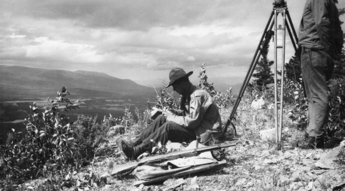

Among the Corps specialized topographic units, the 29th was the oldest. Company D had detachments with all of the regiments in the Northern Sector. Knowing that the tribes of the First Nations had followed trails through this wilderness for a millennium, the lead elements of the 29th turned to them for help.
One Capt. Cassano paired with Johnny Johns, a Tlingit guide, to make the first recon for the 93rd south and east of Carcross. Johns had operated his outfitting business since 1917 and the rumor among the locals was that he made sure the road accessed all of his favorite fishing and hunting spots. Be that as it may, the surveyors of the 29th, coping with the unique difficulties presented by the Yukon Territory, needed all the help they could get.

For just one example. . .the surveyor’s most important tool is his compass and compasses behave very differently in proximity to the North Pole than they do anywhere else. The magnetic North Pole and the geographic one are not the same. From a distance of thousands of miles, the distance between them is trivial. From a distance of a few hundred miles, it is not at all trivial. Worse it changes as you move closer to or further away from the poles.
The lead bulldozers followed the red and white ribbons left tied to trees and stakes by the 29th, but they were in a hurry. On more than one occasion the 29th wound up following the dozers.
In the end, though, the topographers got the last word. Their final survey and map was the official record for the Corps


